Explore the best places
Results for Serra+da+Estrela in Portugal
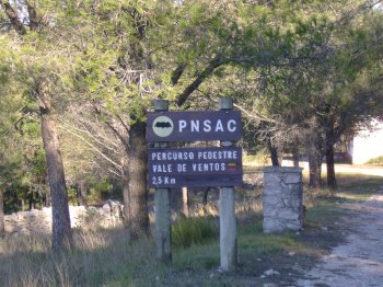
Percurso Pedestre Vale de Ventos
- country
Rua Doutor Augusto César Silva Ferreira
2040, Alcobertas
2.5 km path integrated in the Natural Park of Serras de Aire e Candeeiros. The point of departure and arrival is the reception centre of Valley of winds. Its main points of interest-traditional architecture, fauna and flora and panoramic views make this tour a pleasant surprise.
Mosteiro
- country
- heritage
Mosteiro
3570, Mosteiro
A village at the pena Verde parish, mostly famed for its gastronomy and its culture. It has around 200 inhabitants who are mostly farmers and cattle raisers. There is a yearly Estrela Mountain cheese celebration. It also has colourful celebrations every two weeks.
Zona de Lazer de Covas
- country
- leisure
EN 301
4920, Vila Nova de Cerveira
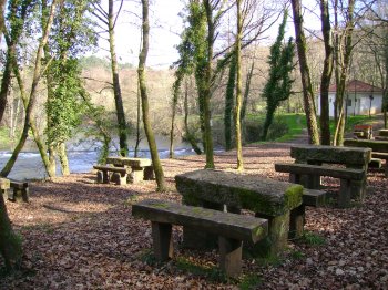
Wide green area located next to EN 301, between the Serra de Arga and the Sierra de graves. The room has tables and benches and access to the river Coura.
Barragem de Odeleite
- beach
- country
Odeleite
8950, Odeleite
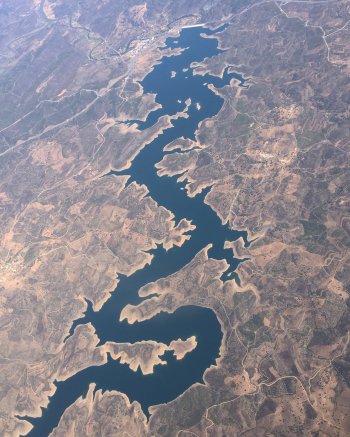
Located in Odeleite, Castro Marim, this dam was built in Ribeira de Odeleite, which is born in Serra do Caldeirão. As a curiosity, aerial photography shows the shape of a blue dragon.
Levada dos Cedros
- beach
- country
ER209
9270, Ribeira da Janela
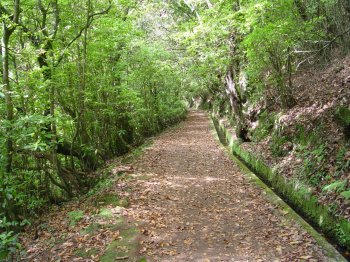
Levada dos Cedros is one of the many typical irrigation canals in Madeira, originating in the outcrops of Lombo do Cedro, at around 1000 meters above sea level, on the eastern slope of Ribeira da Janela. Along the canal, it is possible to observe indigenous vegetation such as leaf litter, grapevines and uveiras-da-serra. It is one of the oldest levadas on the island, built in the 17th century and, like its counterparts, it is used to collect water and convey it to areas for agricultural and domestic use. It is included in the Laurissilva World Heritage classification and is part …
Caos Granítico das Muas/ Arnal
- country
EM1214
5000, Arnal
Localizado na serra do Alvão, o aos granítico de Arnal apresenta uma paisagem única de rocha nua, que contrasta com o verde do vale. Pode conhecer esta paisagem fazendo o percurso Agarez - Arnal.
Lagoa Comprida
- beach
- country
EN339
6270-277, Seia
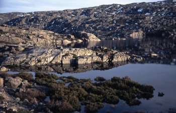
A lagoon with a length of 2500 metres and a width of 130 metres, located in the Estrela Mountain Natural Park, near the Escura, Seca and Redonda lagoons. The mountain scenery stands out for being covered with grass, due to the abundant rainfall. Huge granite blocks are also visible.
Linhares da Beira
- country
- heritage
Linhares da Beira
6360-080, Celorico da Beira
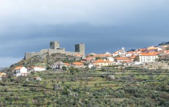
Linhares da Beira is located at an altitude of 810 metres on the foothils of the Estrela Mountain. Its origins dat back to 850 bC, when it was occupied by the "Túrdulos". It was later crossed by the roman road that linked Emérita to Braga and thre are still vestiges of the road and of the roamn forum. The castle, a national monument, was built in 1291, in the reign of Dom Dinis, and has two towers. The mother church, from the 12th century, has three paintings by Grão Vasco. A special note to the manuelin pillory, the Casa da …
Ecopista da Linha do Tâmega
- country
Rua Doutor João Lemos
4890, Celorico de Basto
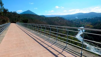
A Estação de Celorico de Basto é o espaço central da Ecopista da Linha do Tâmega. Aqui poderá visitar um núcleo interpretativo e ficar a conhecer a história da Linha do Tâmega. Construída no espaço canal da desativada linha ferroviária, destina-se à circulação pedonal ou de bicicleta.
Miradouro de Marvão
- country
- leisure
Largo de Camões
7330, Marvão
To the north of the district capital Portalegre, at an altitude of 862 metres, the Marvão Mountain, from the top of its fortress, has views of the Estrela and Gardunha Mountains (to the north) and the São Mamede Mountain (to the south). Places like Castelo Branco, Alpedrinha or Monsanto are distant dots from here.
