Explore the best places
Discover new places in Montalegre
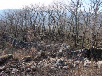
Castro de Vilarinho de Negrões/ Alto do Castro/ Castro do Mau Vizinho
- heritage
Vilarinho de Negrões
5470-323, Negrões
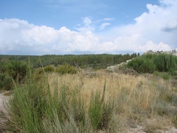
Fortified settlement located on the left bank of the albufeira do Alto Rabagão, overlooking the road that borders. It is a conical hill, with traces of two lines of walls, which in some points fit to rocks. Inside the castro Rocks identified fond, resulting from constructions. The walls are in partial collapse.
Mamoa de Penedos da Lagoa
- heritage
Aldeia Nova de São Mateus
5470-173, Meixedo
Megalithic monument of easy visibility, about twelve feet in diameter and about 0.5 meters high. Does not present any signs of rape, and may be intact. Starting from Montalegre by in 508 linking Meixedo, should follow toward Gralhós\/Firvidas, finding the tumulus at about 100 meters before the intersection of the roads connecting to the new village of São Mateus, Gralhos, Firvidas and Zadjalooooo.
Castro de Mourilhe
- heritage
Mourilhe
5470-311, Mourilhe
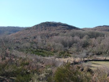
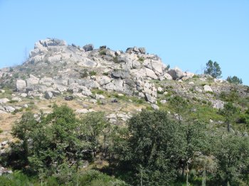
Castro located southwest of Mourilhe, overlooking the ribeira da Pedreira, in line with the castros de Frades. Is covered by a dense undergrowth of Oaks and small and medium businesses. Presents a form roughly circular, surrounded by at least two lines of walls still well percetíveis, among which there are large platforms. On the north side, the defense would be complemented by a moat which precedes the walls.
Mamoa de Marouco do Crasto
- heritage
Lamachã
5470-321, Negrões
It is a megalithic funerary monument, though partly cut by the path that leads to Castro de Lamachã. Features slight central depression and are not visible traces of dolmen, however, are evident the remains of lytic cuirass with abundant quartz stones. Is a prominent, but with little elevation about 11 meters in diameter.
Castro de Lamachã
- heritage
Lamachã
5470-321, Negrões
Iron Age settlement to present a defensive structure consisting of two lines of surrounding walls, and on the East side, by a moat, currently used as a path. On the upper deck are evident the grooves in the rock, where entroncaria the wall. The outer wall was recently reused to support a path. In the intramuros are evident the remains of buildings, having been found by the whole town Indian ceramic fragments.
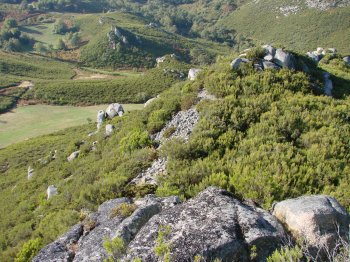
Castro de Parada / Cabeça do Castro
- heritage
Parada
5470-332, Outeiro
Castro deployed down upon the village, on the right side of the road that connects Hill to stop, a granite promontory. It is believed that existed here a fortified settlement, opinion supported by collecting pottery shards and indigenous oral information micácea who claim that here existed walls and remains of dwellings. Currently, there are little evident traces of ancient population occupation.
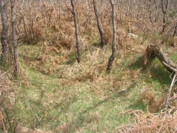
Povoado de Outeiro de Paradela
- heritage
Sirvozelo
5470-334, Outeiro
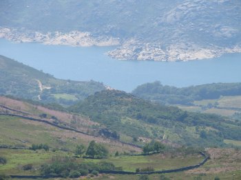
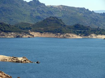
Likely settlement dating back to the Bronze age or the iron age, with wide visibility and easy defense. It is located down upon the albufeira de Paradela and northwest side of the village of Sirvozelo. In the North and East wide platforms are identified, where there seem to be traces of structures. Potsherds have been found prehistoric, tastefully unrefined, incisa.
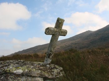
Povoado de Larouquinho
- heritage
Larouquinho
5470-341, Padornelos
According to the oral tradition and also in accordance with the Charter of Dom Sancho I, confirmed by Dom Afonso III, it is believed that on this site, located in the foothills Northwest of Larouco, was one of the terms and Padornelos villages. Referred to as Larouquinho or fields, currently the biggest evidence is a cruise on a small granitic outcrop, with an inscription with the date 1767. Is placed diagonally on top of a rock, which has drawn two sinks, one being that's holding the cruise. The local population confirms the existence, at this location, a village, which was …
Mamoa 2 do Poço de Grou
- heritage
Sendim
5470-342, Padornelos
This is one of the two megalithic monuments located along the road that connects Montalegre to the border, about 400 meters before the last crossing for a planed Sendim tea. The tumulus 2 Crane well, or field of Motorcycles, located just 50 metres from the second, is a monument with "tumuli", with about 14 feet in diameter and about a meter in maximum height. Features a central depression, being visible only a mainstay.
Povoado de Trindades
- heritage
Outeiro
5470-332, Outeiro
Village located about 750 meters Northwest of the village of hill near the road 308-5, in a location occupied by agricultural properties. The structures that have belonged to an ancient settlement are visible only well defined walls alignments and heaps of stones that are said to have been a small village nestled on the mountain. Oral tradition says, in relation to the abandonment of this town, that the main reason was the plague.