Explore the best places
Discover new places in Montalegre
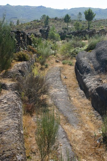
Via Romana XVII do Itinerário de Antonino
- heritage
Arcos
5470-051, Montalegre
Via built during the Julio Claudian, considered one of the most important sections and with more loot Via XVII of the Antonine itinerary. Starting from Gralhós, this route follows the path of Avessó, Ribeira do Cargual, Porto da Geia and Suavila, to enter the village of bark, in the parish of deer. It is believed that on this site via could have two strokes; the first beneath the village, plus the right, between a vampire, now flanked by walls, which possibly in winter would be soaked and another stroke at the top of the village. These two routes are then …
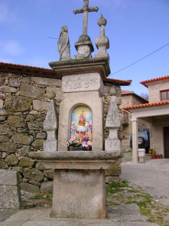
Alminhas com Relógio de Sol de Sabuzedo
- heritage
Sabuzedo
5470-312, Montalegre
Stone building with a statue of our Lady in tiles, with the date of 1858 entered. At the top, lies a sundial along with a small cross and a pinnacle.
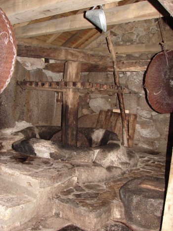
Lagar de Azeite de Cabril
- heritage
CM1021
5470-012, Montalegre
Olive oil mill, hydraulic engine Cabril which is situated next to the entrance of the village, which allowed for many years the making of olive oil from this region. Currently no longer works, either for lack of olives, or by any simpler means that do not require such large amounts. Its conservation status is not very good, but has the essential elements to be used with great accuracy and allow the recovery of tradition for filmic record.
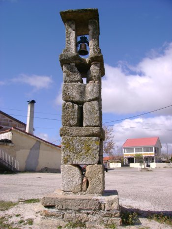
Torre Sineira de Solveira
- heritage
Solveira
5470-480, Montalegre
Small Tower consisting of some overlapping stones, with a Bell Tower on top, protected by a stone structure.
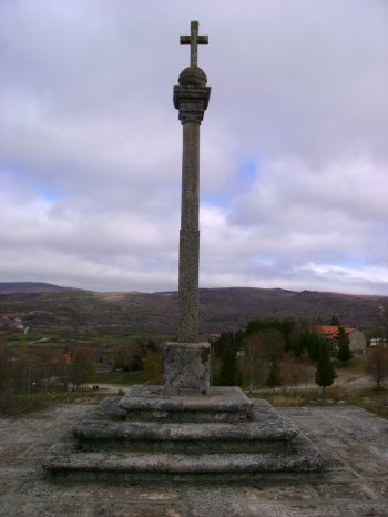
Calvário de Meixedo
- heritage
CM1006
5470-173, Montalegre
Set of seven stone crosses, located behind the Church, being the larger Center. Displays the date of 1720.
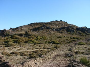
Povoado de Corucho/ Coroa do Coto
- heritage
Cambeses do Rio
5470-042, Cambeses do Rio
Fortified settlement of pre-Roman times located at 1175 metres maximum elevation North of the village of Friars and with reference to the GEODESIC mark of Friars. The sock is perfectly visible slope a line of walls that surrounds the mound and before a broad platform where possibly settled the constructions. On the upper deck, where the landmark GEODESIC, there is great concentration of stones, which the popular claim to have been brought there to build a chapel. Beyond the line of walls, do not identify other constructions, also due to the density of undergrowth.
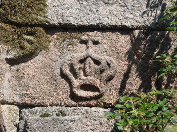
Cruzes de Susana
- heritage
Azevedo
5470-011, Montalegre
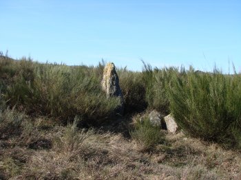
Set of two medium-sized granite outcrops, located next to a path built to remove wood. Every rock has recorded a small cross, being the first single and the second showing a triangular base.
Mamoa 2 de Pereiro
- heritage
Cambeses do Rio
5470-041, Cambeses do Rio
This megalithic monument would integrate the set of at least three tumuli, along with the Tumulus 1 of Pereiro and the Tumulus of Arregada. Features about 8\/10 metres maximum diameter and a slight central depression, not being visible Struts. However, there are a few stones in the surrounding area of walls that may have been mainstays.
Povoado de Cerca
- heritage
Cabril
5470-013, Cabril
It is a small mound located in the left margin of the Rio Cabril, on the medieval bridge. This location is the village's oldest urban core, existing currently in the upper deck, next to the cemetery, the building of the National Park of Peneda Gerês. It is believed that it was occupied in antiquity, not existing but archaeological remains that show.